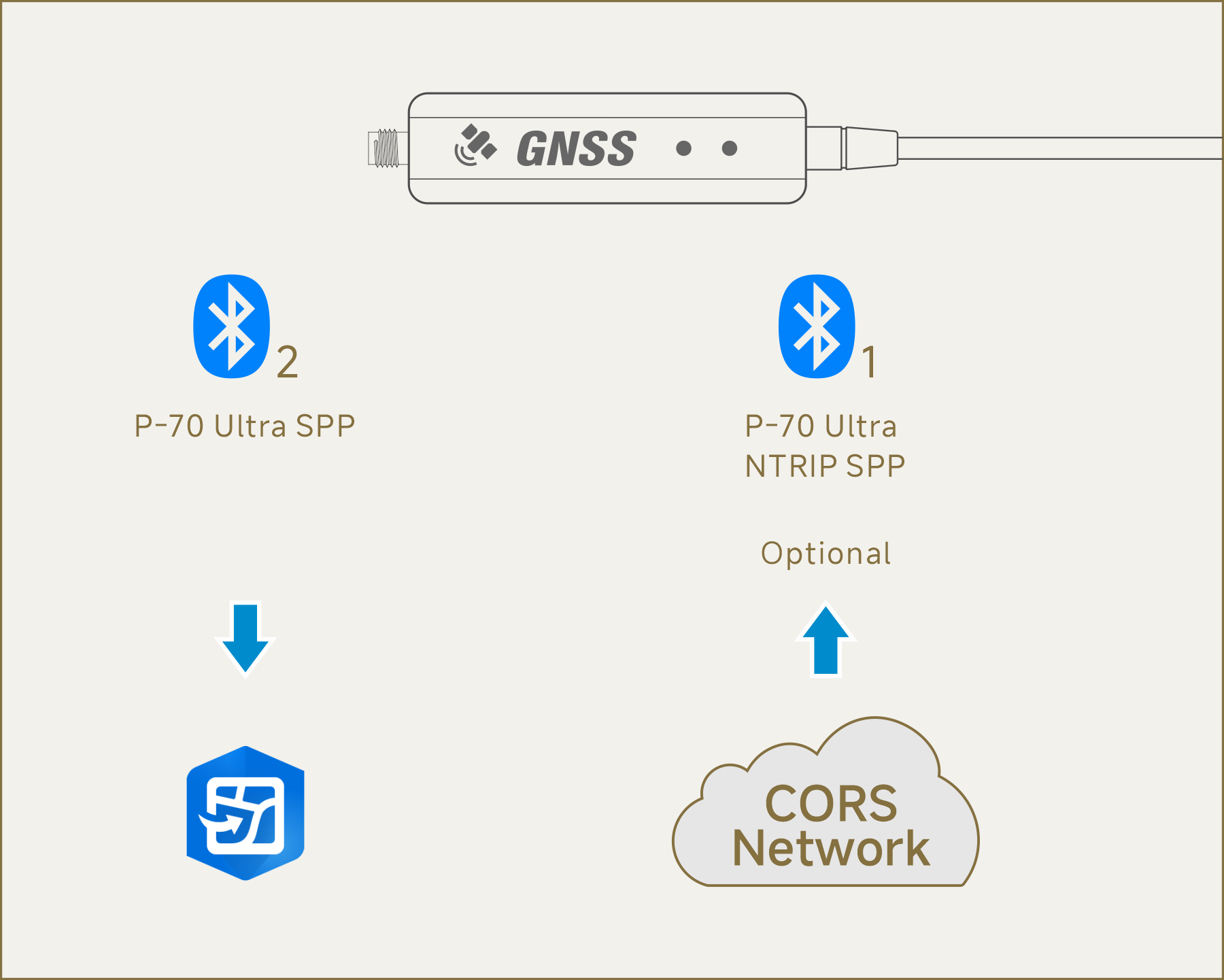
|
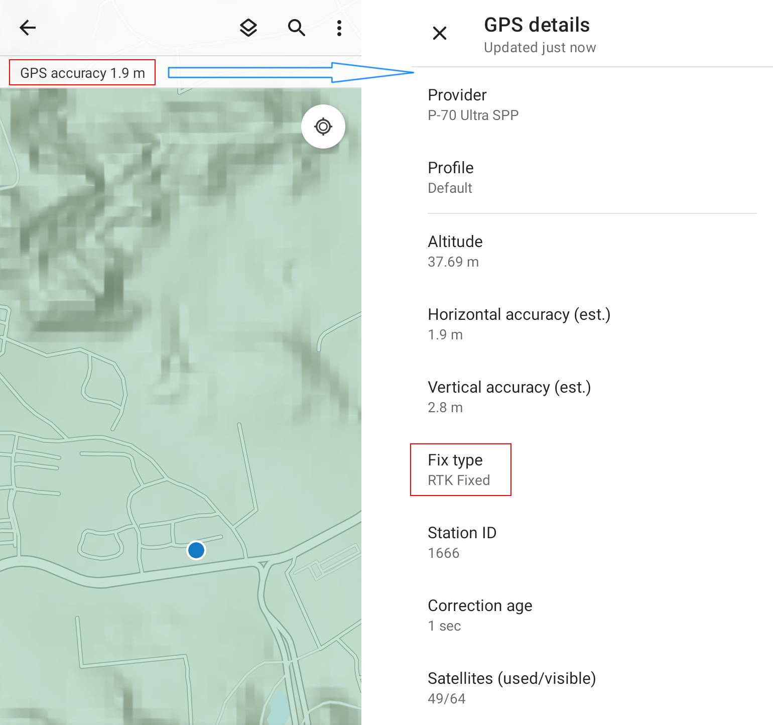
 In the map
interface, tap the "GPS accuracy" in the upper left corner. When positioning
information appears on the GPS details page, the connection is successful, and
the Bluetooth Lamp on the P-70 Ultra will light up. In the map
interface, tap the "GPS accuracy" in the upper left corner. When positioning
information appears on the GPS details page, the connection is successful, and
the Bluetooth Lamp on the P-70 Ultra will light up.
 When the Fix type is RTK Fixed, the positioning accuracy
can reach 1 cm. At this time, the GPS accuracy value is not relevant.
When the Fix type is RTK Fixed, the positioning accuracy
can reach 1 cm. At this time, the GPS accuracy value is not relevant. |