|
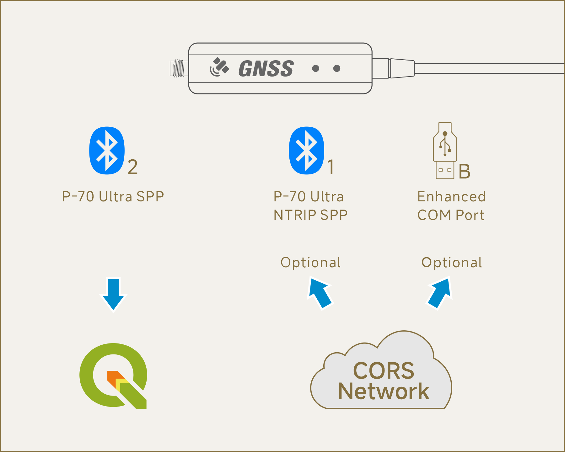
Since QGIS does not support USB / Serial devices with a baud rate of 230,400 bps, you
can connect to QGIS via Bluetooth instead.
Additionally, QGIS does not support providing NTRIP data to the P-70 Ultra. It
is recommended to use other App to access the NTRIP service for
centimeter-level positioning accuracy (Optional). For more details,
please refer to> |
|
Using "Windows" as an example: |
|
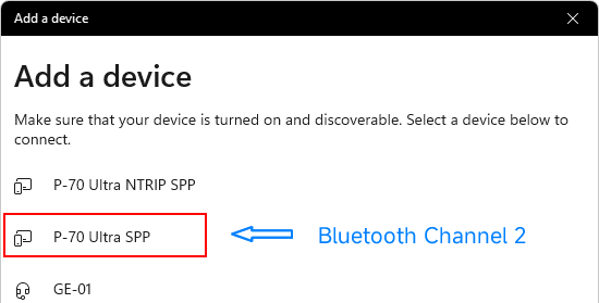
 Preparation: Pair "P-70
Ultra's Bluetooth Channel 2" with Windows. For more details,
please
refer to> Preparation: Pair "P-70
Ultra's Bluetooth Channel 2" with Windows. For more details,
please
refer to> |
|
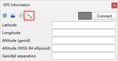
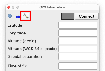
 Open "QGIS", press "Ctrl +
0" to open the "GPS Information" page, and click "Settings". Open "QGIS", press "Ctrl +
0" to open the "GPS Information" page, and click "Settings". |
|
 Click "GPS
Settings...". Click "GPS
Settings...". |
|
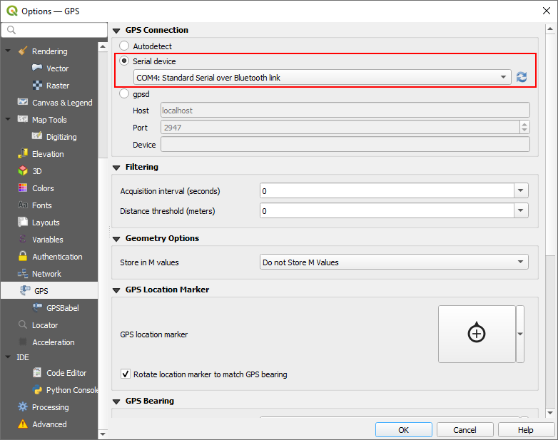
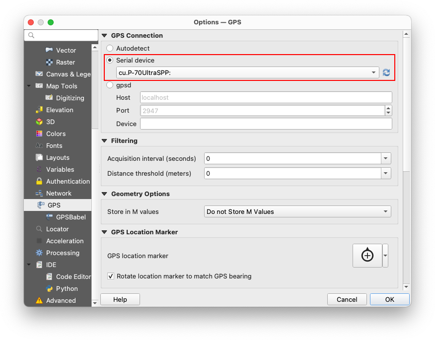
Click "Serial
device", then select "Standard Serial over Bluetooth link".
 The port number generated varies by computer. Use the
actual port number on your system rather than the one shown in example
screenshots.
The port number generated varies by computer. Use the
actual port number on your system rather than the one shown in example
screenshots.
When selecting a Bluetooth port, baud rate settings are not required. |
|
|
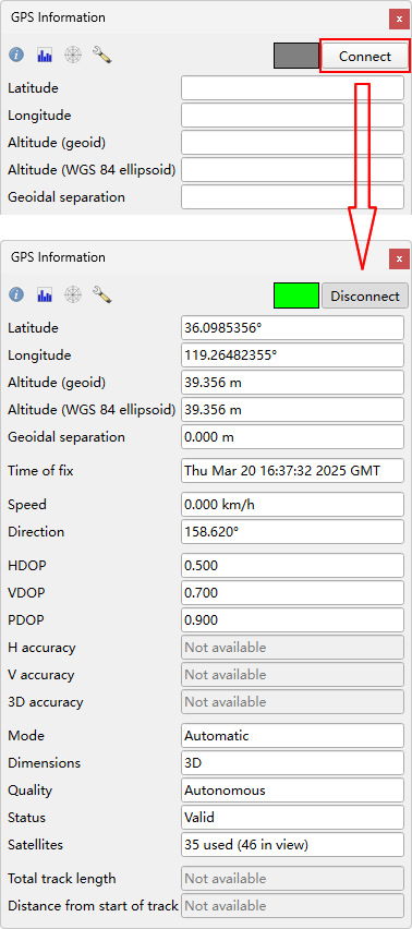
Click "Connect".
Once positioning data appears, the connection is successful, and the Bluetooth
Status Lamp will turn on. |
|
Using "macOS 15" as an example: |
|
|
Preparation: Pair P-70
Ultra's Bluetooth Channel 2 with macOS. For more details,
please
refer to> |
|
Open QGIS, press "Ctrl + 0"
to open the "GPS Information" page, and click "Settings". |
|
Select "P-70
Ultra SPP". |
|
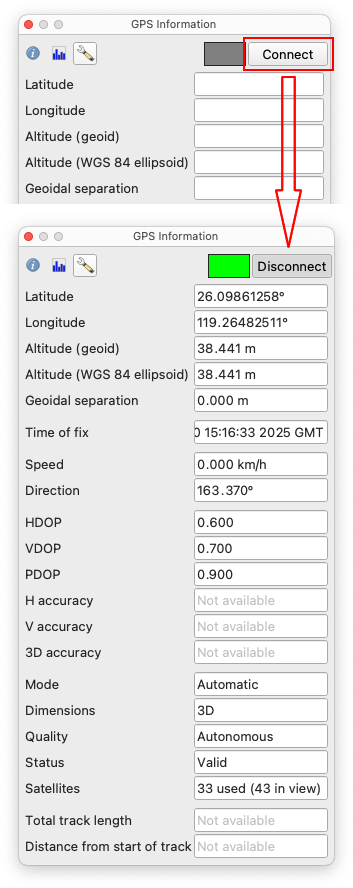
Click "Connect".
Once positioning data appears, the connection is successful, and the Bluetooth Lamp will turn on. |
|